Blog
All Blog Posts | Next Post | Previous Post

 Using tileserver services in TMS FNC Maps for Delphi
Thursday, October 12, 2023
Tileservers can be used to display custom maps that are tailored to your specific needs. Different geographical map representations are possible. Some of the most common types of maps include street maps, topographic maps, and satellite imagery.
Switching maps in TMS FNC Maps for Delphi is easy. Enter the URL of your preferred tileserver provider and the map changes instantly. In this blog post you'll find out how using tileservers works and a quick overview of available tileservers.
Availability
Please note that using custom tileservers is only supported in TTMSFNCLeaflet and TTMSFNCOpenLayers. Both XYZ and WMS type tileservers are supported.
A detailed mapping services comparison is available in this blog post: Comparing mapping services in TMS FNC Maps for Delphi
Code Samples
The XYZ type tileservers only require setting an URL. However, the WMS type tileservers also require setting the Layers parameter. WMS tileservers can include multiple layers. With the Layers parameter the desired layer to display can be selected.
Some tileservers provide transparent layers while other layers cover the map completely. The visibility of the default base layer can be controlled with the ShowBaseLayer property. Multiple layers can be combined as well. A code example is available in this blog post: Discover open source maps in Delphi with Leaflet
Usually it is required to attribute the service used. The attribution text is specified in the details for each service. When using TTMSFNCLeaflet, this text can be added on the map by using the AttributionText property.
var
  ll: TTMSFNCLeafletTileLayer;
begin
  TMSFNCLeaflet1.BeginUpdate;
  TMSFNCLeaflet1.Options.ShowBaseLayer := False;
  TMSFNCLeaflet1.Options.AttributionText := 'Kartendaten: © <a href="https://openstreetmap.org/copyright">OpenStreetMap</a>-Mitwirkende, SRTM | Kartendarstellung: © <a href="http://opentopomap.org">OpenTopoMap</a> (<a href="https://creativecommons.org/licenses/by-sa/3.0/">CC-BY-SA</a>)';
  TMSFNCLeaflet1.ClearTileLayers;
  ll := TMSFNCLeaflet1.AddTileLayer('https://a.tile.opentopomap.org/{z}/{x}/{y}.png');
  ll.Source := lsXYZ;
  TMSFNCLeaflet1.EndUpdate;
end;
WMS
var
  l: TTMSFNCLeafletTileLayer;
begin
  TMSFNCLeaflet1.BeginUpdate;
  TMSFNCLeaflet1.Options.ShowBaseLayer := False;
  TMSFNCLeaflet1.Options.AttributionText := 'Maps © <a href="https://www.terrestris.de/">Terrestris</a>, Data © <a href="https://www.openstreetmap.org/copyright">OpenStreetMap contributors</a>';
  TMSFNCLeaflet1.ClearTileLayers;
  l := TMSFNCLeaflet1.AddTileLayer('https://ows.terrestris.de/osm/service?');
  l.Params.Layers := 'OSM-WMS';
  l.Source := lsWMS;
  TMSFNCLeaflet1.EndUpdate;
end;
Note: These code samples are based on TTMSFNCLeaflet. The same code can be used for TTMSFNCOpenLayers.
Overview
There are so many tileserver services out there, it would be impossible to list them all here. Below is a small overview of some of the available tileserver services. Follow the links to the services for detailed information. *
Some services provide worldwide maps in multiple styles and optional extra layers. Some services only provide tiles and/or layers for a specific geographic location. Some services are free to use, others offer a paid subscription. Some services require an API key. Some services provide map tiles with labels in English, others provide labels in the regional language of the geographic location on the map.
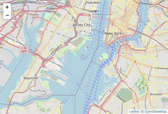
OpenStreetMap
The default tileserver for both Leaflet and OpenLayers. This map is visible automatically, no code changes are necessary.https://www.openstreetmap.org/
Type:
XYZ
Authentication:
N/A
Attribution:
© <a href="https://www.openstreetmap.org/copyright">OpenStreetMap contributors</a>
URL example:
https://a.tile.opentopomap.org/{z}/{x}/{y}.png
Locale:
Regional
Pricing:
Free
Stadia Maps
Different map types & layers available.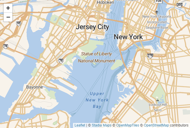
Type:
XYZ
Authentication:
API key
Attribution:
© <a href="https://stadiamaps.com/" target="_blank">Stadia Maps</a> © <a href="https://openmaptiles.org/" target="_blank">OpenMapTiles</a> © <a href="https://www.openstreetmap.org/about" target="_blank">OpenStreetMap</a> contributors
URL example:
https://tiles.stadiamaps.com/tiles/outdoors/{z}/{x}/{y}.png?api_key=(apikey)
(replace "(apikey)" with your own API key)
Locale:
Regional + English
Pricing:
- Free for non-commercial use. Limited # of requests
- Different price tiers for commercial use
OpenTopoMap
OpenTopoMap is a free topographic map generated from OpenStreetMap and SRTM elevation data.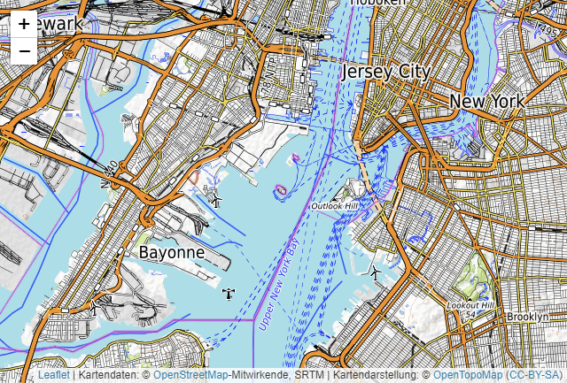
Type:
XYZ
Authentication:
N/A
Attribution:
Kartendaten: © <a href="https://openstreetmap.org/copyright">OpenStreetMap</a>-Mitwirkende, SRTM | Kartendarstellung: © <a href="http://opentopomap.org">OpenTopoMap</a> (<a href="https://creativecommons.org/licenses/by-sa/3.0/">CC-BY-SA</a>)
URL example:
https://a.tile.opentopomap.org/{z}/{x}/{y}.png
Locale:
Regional
Pricing:
Free
ThunderForest
Different map types available.https://www.thunderforest.com/
Type:
XYZ
Authentication:
API key
Attribution:
Maps © <a href="https://www.thunderforest.com">Thunderforest</a>, Data © <a href="https://www.openstreetmap.org/copyright">OpenStreetMap contributors</a>
URL example:
https://tile.thunderforest.com/landscape/{z}/{x}/{y}.png?apikey=(apikey)
(replace "(apikey)" with your own API key)
Locale:
Regional + English
Pricing:
Different price tiers, including a free tier. Limited # of requests.
ArcGis Online
Different map types & layers available.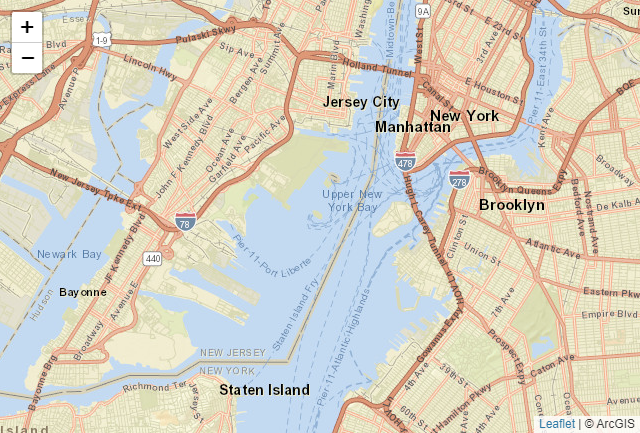
Type:
XYZ
Authentication:
N/A
Attribution:
© ArcGIS
URL example:
http://server.arcgisonline.com/ArcGIS/rest/services/World_Street_Map/MapServer/tile/{z}/{y}/{x}
Locale:
English
Pricing:
Contact ArcGis Online
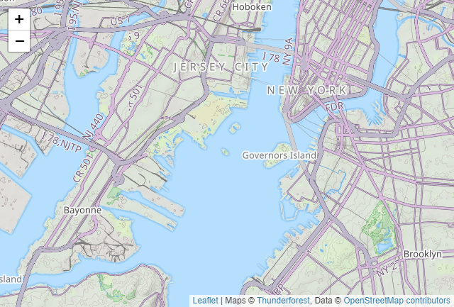
Terrestris
Open source. Different map types & layers available.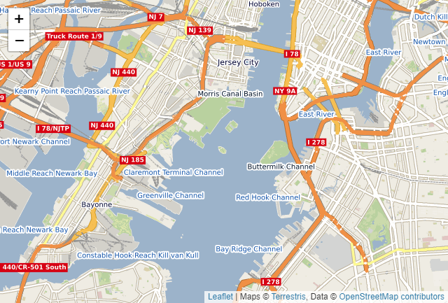
Type:
WMS
Authentication:
N/A
Attribution:
Maps © <a href="https://www.terrestris.de/">Terrestris</a>, Data © <a href="https://www.openstreetmap.org/copyright">OpenStreetMap contributors</a>
URL example:
https://ows.terrestris.de/osm/service?
Layer name example:
OSM-WMS
Locale:
Regional (+ country names in English)
Pricing:
Free
* Prices, features and service availability are subject to change
Available Now
The TMS FNC Maps is available now for Delphi & Visual Studio Code (with TMS WEB Core). You can download the latest version and start using all these features right away!
Bart Holvoet
Related Blog Posts
-
Comparing mapping services in TMS FNC Maps for Delphi
-
Comparing directions services in TMS FNC Maps for Delphi
-
Comparing geocoding services in TMS FNC Maps for Delphi
-
Using tileserver services in TMS FNC Maps for Delphi

This blog post has not received any comments yet.
All Blog Posts | Next Post | Previous Post